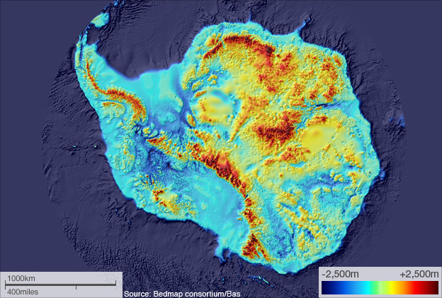

Scientists have made a detailed map of Antarctica's rock bed — what the land looks like underneath the ice — as part of their attempt to predict how the continent might respond to global warming.
Figuring out what will happen when Antarctic ice melts requires an understanding of what's going on down below:
Scientists are currently reporting significant changes at the margins of the continent, with increasing volumes of ice now being lost to the ocean, raising global sea levels. The type of information contained in BEDMAP will help researchers forecast the pace of future events.
"This is information that underpins the models we now use to work out how the ice flows across the continent," explained Hamish Pritchard from the British Antarctic Survey (BAS).
Also, it looks rad. Live nude landmass!