

Hurricanes inflict some of their greatest damage by pushing walls of water onto land, in what are called storm surges. The National Oceanic and Atmospheric Administration (NOAA) estimates that Hurricane Irene may generate peak surges of up to 10 feet high in places along the Mid-Atlantic coast. Tall wave action will compound the threat in exposed areas. And over the last century, mostly due to global warming, sea level has risen about a foot along much of the coast, placing even more people and homes at risk than would have otherwise been the case.
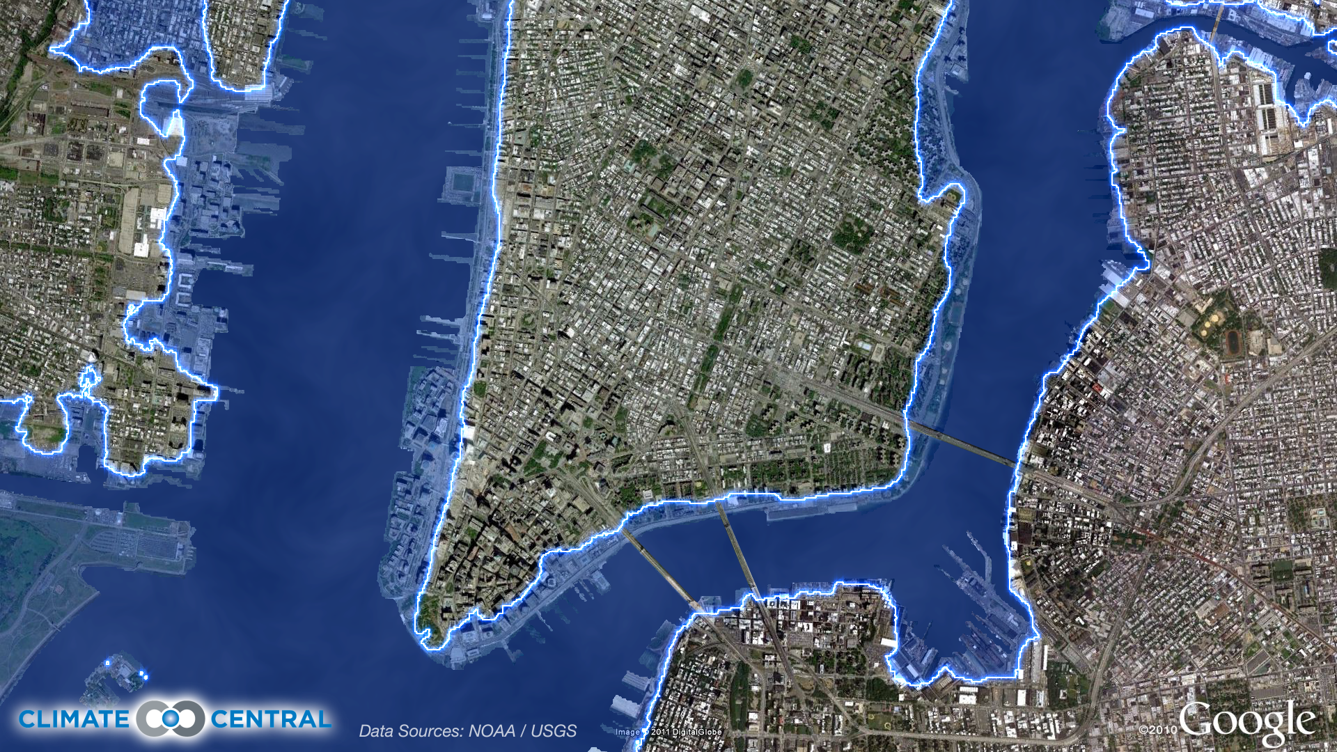
This map below shows lower Manhattan and parts of Brooklyn and New Jersey. The blue area identifies the land zone within five vertical feet of the average high tide line, toward the upper end of the range of surge heights NOAA is predicting for the immediate area. Based on 2010 Census information and Climate Central’s map analysis, almost a quarter million (233,000) people live in this zone for all of New York City. That’s 28 percent (65,000 people) more than live within the four-foot zone — the line we would be talking about if the sea hadn’t risen a foot over the last hundred years. About two-thirds of that rise appears to come from global warming.
This map is not intended to predict the flooding risk from Irene, which will come from complex combinations of surge, wind, and wave action. It merely illustrates land area less than five feet above the average high-tide line.
Click to see a larger version.
