 Jonathan Waterman is the author of the book Running Dry about the Colorado River. He began his journey at the river’s headwaters in Rocky Mountain National Park, hiking with Brad Udall, director of Western Water Assessment, to La Poudre Pass on the Continental Divide. Along with his packraft and snowshoes, the author carries the ashes of his recently diseased mother in his pack, to join him on his 1,450-mile paddle (and snowshoe) from source to sea. The following is the first of two excerpts from the book.
The high altitude, opaque stream water beside us turns chocolate as the temperature rises, and water begins to pour out of untold ravines, unlocking mud banks, thawing snowfields, and bursting toward sea level more than a thousand miles away. The pace of my hiking companion, Brad Udall, quickens, even though his pack — freighted with heavy-metal backcountry skis and bindings — is a great deal heavier than mine. Brad is vexed that the Colorado River no longer reaches the sea. The water beelining past our feet and wetting our socks should “slake the thirst of you, me and thirty million others who live in this gargantuan river basin, or evaporate from immense desert reservoirs downstream.”
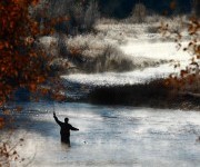
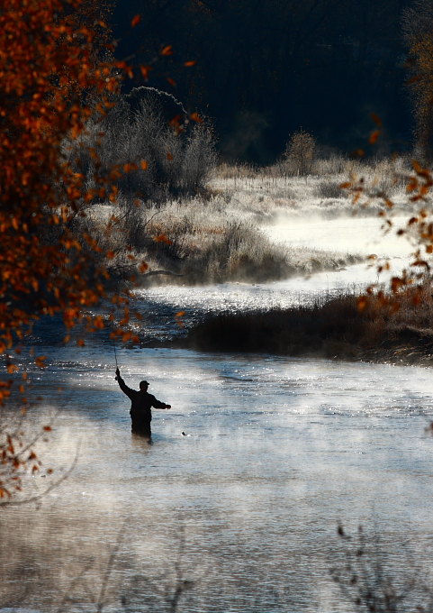 Gold medal fishing in the Colorado headwaters, recently declared the 6th most endangered river in the U.S.Photo courtesy of Jonathan WatermanHe talks with the slow cadence of a native Westerner. His mind holds a hard-earned map of the rivers and ranges of these parts. Nor does it hurt that five generations and two dozen of his kin have run municipal, state, or federal political offices. Since the mid-19th century, the Udall family, like all Western political dynasties, has trafficked in water. Or the lack thereof. So it’s not a stretch to say that the river runs through Brad Udall’s veins.
Brad, pushing 50-years-old, churns out water facts as we follow the stream growing beside us. A former boatman in the Grand Canyon, he’s fit from backcountry skiing those weekends he doesn’t hit the lecture and sustainable water use circuit as the director of Western Water Assessment, based out of the National Oceanic and Atmospheric Administration (NOAA) offices in Boulder.
We ford a rivulet, climb another steep hill, and amid a thick pine forest, tiptoe across the crust of melting snowbanks, mined with three-foot sunken leg holes of hikers who passed earlier in the week without snowshoes. In a sun-drenched meadow, a kingfisher zippers through the air, rattling loudly against our intrusion. We stop and strip off our outer jackets as the now meandering stream lowers its burbling a decibel.
From ferries to federal offices
In northern Arizona during the late 19th century, Brad’s great-great-grandfather, John D. Lee, started Lees Ferry, pulling flat-bottomed boats across the river with a cable. A dozen miles upstream of this landmark, in 1961, Brad’s uncle, Secretary of the Interior Stewart Udall — aka “Colorado River Master” — oversaw the building of the West’s most disputed mass of concrete, the Glen Canyon Dam. His father, “Mo” Udall, was the one-time presidential candidate and Arizona representative who defended that state’s Colorado River water rights, while Brad’s brother Mark and their cousin Tom represent Colorado and New Mexico as congressmen now running shoo-in campaigns as senators. No one would dispute that Brad has found his calling as a spokesman for the river.
He says that today’s growing problem with the shrinking river began with a climate miscalculation. Beginning in 1896, the U.S. government measured the Colorado River volume through acre-feet, the amount of water that would cover an acre of land one-foot deep. They guesstimated the river’s average flow at 17.5 million acre-feet (maf), almost 6 trillion gallons per year.
That’s enough water to support 35 million modern households.
Yet scientists have recently figured out that the Colorado River’s volume was calibrated following one of the wettest periods in its history. By measuring the distance between tree rings, hydrologists found growth rates that matched river volumes. Hydrologists determined that the region has experienced more severe droughts over the last several hundred years, Brad tells me, than yet experienced in the 21st century. This means that droughts are going to get worse before they get better. Over the centuries, the river has averaged little more than 15 maf per year — 2.5 maf less than the seven member states and Mexico have divvied up. I’ll learn more about the significance of these numbers as I head downstream.
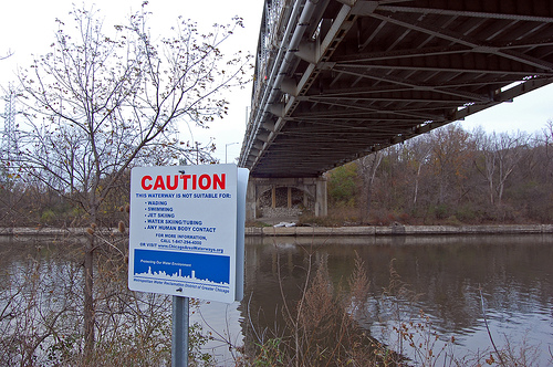
I have come to the Colorado River to paddle all 1,450 miles and learn about what’s at stake. Not only what’s already been damaged, but also what we might lose in the future without proper solutions or conservation. Water, first of all. Then more cogently, the river itself, a living resource that includes wildlife and plant species, reservoirs, Native American culture, recreation, river-based economies, and the ever-shrinking wetlands of the delta. My family lives in Colorado and I want them to revel in the living resource of water — skiing the Rockies’ snow, paddling its melt waters, and watering our garden — as I have for the last 20 years. But a half century from now, according to the forecasts of many climatologists, my sons are likely to see the ski resorts of Colorado go dry before their knees give out.
Climate models for the second half of this century show that up to 70 percent of the snowpack, which supplies the river 90 percent of its water, will disappear. Despite a whopping snowfall and long winter in the Upper Basin, the two biggest reservoirs created by Hoover and Glen Canyon Dams, “Lakes” Mead and Powell, are presently at half of their collective 50-maf capacities and are unlikely to recharge from the winter’s big snowfall after meeting their downstream orders to create electricity and fill irrigation ditches.
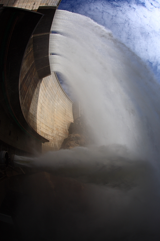 Over a hundred dams contain the river water, both inside and outside of the Colorado River Basin.Photo courtesy of Jonathan WatermanIf this nine-year drought continues on beyond a decade, as predicted, life throughout the river basin will be irrevocably changed. First, the sprawling economy created by recreational river and reservoir use throughout the river basin will go bust — crippling scores of towns and small cities along the river. Swimming pools will be drained and lawns browned in Salt Lake City, Utah; Cheyenne, Wyo.; and Albuquerque, N.M. Without Hoover Dam generating relatively clean and rapidly created hydroelectric power, Los Angeles will have blackouts. Without Glen Canyon Dam powering air conditioners, people will abandon sweltering Phoenix, necessitating the construction of more noxious, water consumptive coal plants on the far reaches of the energy grid. Several million acres of farms in the Southwest — including Imperial Valley, the fifth richest agricultural region in the country — will go fallow. Without radical change, citizens in Denver, Colo.; Las Vegas, Nev.; and San Diego, Calif., will have trouble flushing their toilets. Thirty million people will begin losing their drinking water. Finally, thanks to the antiquated Colorado River Compact, lawsuits will lock up wh
at little water remains in what is already known as the most diverted river in the world.
More people, less water, higher temperatures
Today, the driest states in the country are now among the most water-dependent and fastest-growing states. Eight decades ago, the Colorado River Compact split up the river between Mexico, Arizona, California, Nevada, New Mexico, Utah, Wyoming, and Colorado. In that time, the basin states’ population of five million increased tenfold. Compounding this dilemma are droughts, an over-allocated river, and increasing global temperatures.
Brad’s brow furrows as he discusses the shrinking river. He fires off facts and figures with the speed of a Wall Street ticker tape showing the futures market. Keeping to the Western Water Assessment’s mission of science, he avoids the rhetoric of environmentalists.
Like the other jack Mormons in his family, he is lean and tall, with thick eyebrows, and a long jawline that contributes to a craggy handsomeness. As the snow deepens, Brad and I are happy to lighten our packs by caching our five-pound Alpacka rafts and paddles in a greening aspen forest. We strap on our skis and snowshoes. It would be vainglorious to try to boat down the snowed-over, steepening stream.
Brad points to La Poudre Pass, our destination, where the Continental Divide runs north to south, dividing Rocky Mountain National Park hydrologically. Waters on the west side form the Colorado River headwaters, running to the Pacific, while the east side drains to the Mississippi and the Atlantic. At least this is how nature intended it.
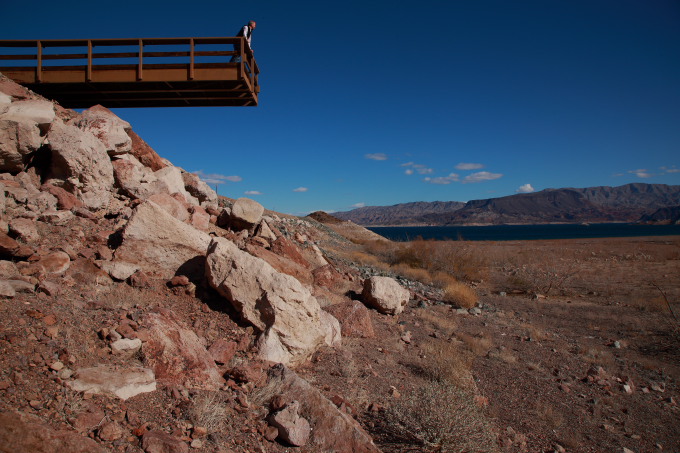 Lake Mead, the largest reservoir and water bank on the river system, teeters toward being overdrawn.Photo courtesy of Jonathan WatermanAbove our heads, the Never Summer Mountains hold the snow that used to form the first drops of the river. Before this snowmelt can drain into the shrunken stream at our feet, a ditch intercepts the water, sluicing it over La Poudre Pass into Long Draw Reservoir, and off to the crops on the eastern plains. The ditch appears like a surgical scar shaved across the heavily wooded face of the Never Summers. Farther west, a bulldozer rumbles along an adjacent dirt road, clearing out ice jams to keep the water from flooding over the ditch and into the valley below. Brad’s congressman brother, Mark Udall, has championed a bill that will make this corner of Rocky Mountain National Park official wilderness. Five years ago, the ditch flooded the park’s valley floor and caused $9 million in damage to dozens of historic cabins amid flower-strewn meadows. Now with protected wilderness status, the park can bill the ditch owners for the damage instead of suing.
Like other states in the river basin, Colorado developed around the ability to manipulate water. Financiers knew that “water runs uphill to money,” and so does this ditch, pumped at a one percent grade over the Continental Divide.
As evidence of this water-as-gold maxim, in Colorado, we cannot legally catch rain in our gutters to water our gardens, because Brad and I live under the doctrine of prior appropriation — or first in time, first in right — meaning that someone below us already owns the water. These rights can be bought and sold separately from whatever rights we’d like to think we own on our roofs, high above and far away from any farmer. In times of drought, the owner of the oldest water right, regardless of distance from the river or its headwaters, reserves the right to use the water. This explains why ranchers and farmers 80 miles to the west in Grand Junction, Colo., or 80 miles to the east in Fort Morgan, Colo., own the water that falls on our Carbondale or Boulder roofs.